Current weather drivers – what can we expect?
Oliver Fiddes, 13 September 2024
As we all know, spring is a vital season for crop development in Australia, with winter crops in the yield determination stage of growth, and weather playing a crucial role in this. As we move towards the end of the season, let’s take a look at the primary weather drivers and what we can expect to see as we edge into harvest.
There are three main systems that influence weather for Australia. These are the Southern Oscillation Index (SOI), the Indian Ocean Dipole (IOD) and the Southern Annular Mode (SAM).
Southern Oscillation Index (SOI)
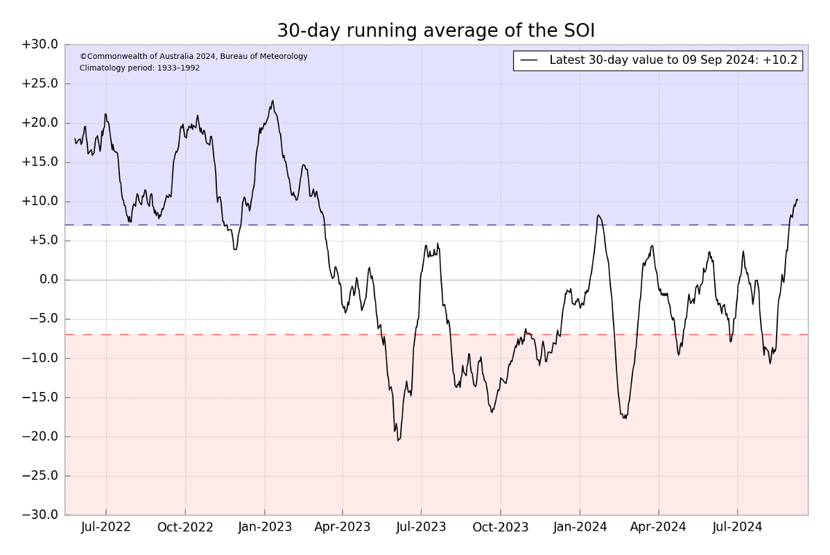
What we have seen over the last 12 months is a fluctuation between an El Nino (SOI -7) and a neutral ENSO (El Nino-Southern Oscillation). This means that weather has been largely dry and unpredictable for much of Australia.
However, since mid-late August, we have seen the trade winds gain momentum between Tahiti and Darwin and with this, the SOI has moved into a weak La Nina episode (SOI +7). What this means for Australia is that we should start to see more predictability in weather patterns and more rainfall across the east coast and SA.
The Madden-Julian Oscillation, which is currently over the maritime continent, is expected to build strength in the trade winds and help a La Nina gain momentum.
Indian Ocean Dipole (IOD)
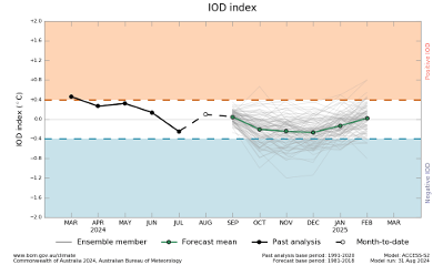
The IOD monitors the relationship between sea surface temperatures in the eastern and western areas of the Indian Ocean.
A positive phase of the IOD means less rainfall for the country, while a negative IOD means more rain for the country.
Much like the ENSO, we have largely been in a neutral state which is likely to continue until the end of the Spring with no big push wetter or drier.
Southern Annular Mode (SAM)
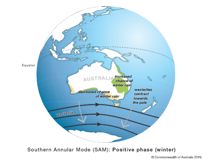
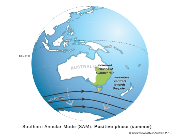
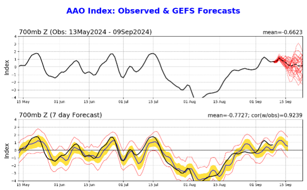
As we enter spring and move into summer, we can expect the SAM to begin to trend into the positive. This typically results in increased chances of rain from NSW through into Victoria and the eastern edge of SA.
Currently the SAM is positive and expected to move into neutral imminently. This means that this weather system will have a minimal effect on Australian weather. This is why we have seen less than optimal levels of rainfall for South Australia over the past few months.
Global weather
Elsewhere in the world, Brazil is facing extremely dry conditions for sowing their new crops following a dry six weeks over harvest.
Alongside this, the EU has had a poor harvest, particularly in France.
The USA has begun their corn harvest with the USDA estimating 5% of the crop has already been harvested. Tropical storm Francine is passing through the Midwest bringing rain and some potential harvest delays, however for the most part, the US is experiencing a moisture deficit to finish both the corn and soybean crops.
The local outlook
Provided this La Nina continues to build, we can expect to see more predictability in the weather systems bringing much needed rainfall to SA and other areas of the east coast. Finishing rains will be crucial in South Australia and Victoria for the national crop to achieve and outperform current near record production estimates.
Earlier this month, ABARES released the most recent Australian Crop Report for the 2024-25 winter crop harvest where it stated production is forecast to increase by 17% from last seasons harvest. If this is the case, it would be the fifth highest harvest on record.
With ongoing market volatility and the continued impacts of weather-related issues as we lead into harvest, utilising Advantage Grain’s dedicated team to manage your grain sales will save you time and could yield real pricing benefits in the new year.
